Thomas Hardy knew about the meaning of Brown in Dorset landscapes. The Return of the Native starts
“A Saturday afternoon in November was approaching the time of twilight, and the vast tract of unenclosed wild known as Egdon Heath embrowned itself moment by moment. Overhead the hollow stretch of whitish cloud shutting out the sky was as a tent which had the whole heath for its floor.”
This was of course parodied to perfection by Monty Python in their novel-writing from Dorchester sketch, possibly the only time our little town was mentioned by the pythonists.
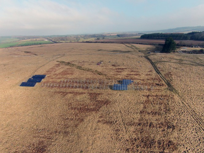
Community Heat and Power (or is it British Solar Renewables?) have kindly published this recent aerial photo of Rampisham Down.
It shows two things very clearly. One is that Rampisham Down is entirely covered by unimproved grassland. The “brown” colour is not related to it being a “brownfield site” despite Local District Councillor Tony Frost’s witty suggestion that it is. It looks brown because the acid grassland plants that grow there have grown ungrazed for a few years (the years during which it has been owned by British Solar Renewables). When grasses and herbs in a wildlife-rich grassland grow without grazing, they flower and then the leaves die back to a brown colour. A grazed grassland would still retain some shades of brown, unless it was so heavily grazed that all the leaves and flower stalks are grazed off.
Note in this photo how green are the fields adjacent to Rampisham Down, again taken by drone for BSR.
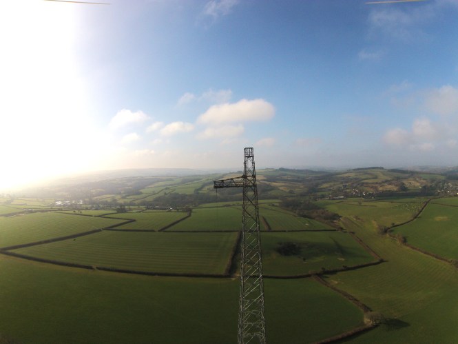
These fields are green because they have plenty of artificial Nitrogen fertiliser applied to them, to make the grass grow more quickly. These are known as Improved grasslands, whereas Rampisham is an Unimproved grassland. Improved grassland sounds like it is better than Unimproved grassland. This is because Improved grasslands can feed more livestock than Unimproved ones.
Unimproved grasslands are much richer in wildlife and archaeology, as well as locking up twice as much Carbon in their soils, helping to clean pollutants from drinking water, and providing homes for pollinators such as Bumble Bees, as well as providing many other benefits to people. More information on the value of Unimproved Grasslands can be found in this report.
The second point is that the drone photo shows clearly that Rampisham Down is not a Brownfield Site. Brownfield, also known as Previously Developed Land is defined by the NPPF as:
While the buildings at Rampisham are clearly developed, they only take up a tiny proportion of the whole site (and are excluded from the SSSI). The other permanent structures include the concrete platforms for the masts. These are each roughly 10x10m, so for 35 masts the total area is 0.35ha. The ducting which used to take electricity to the masts also occupies perhaps 1 hectare in total.
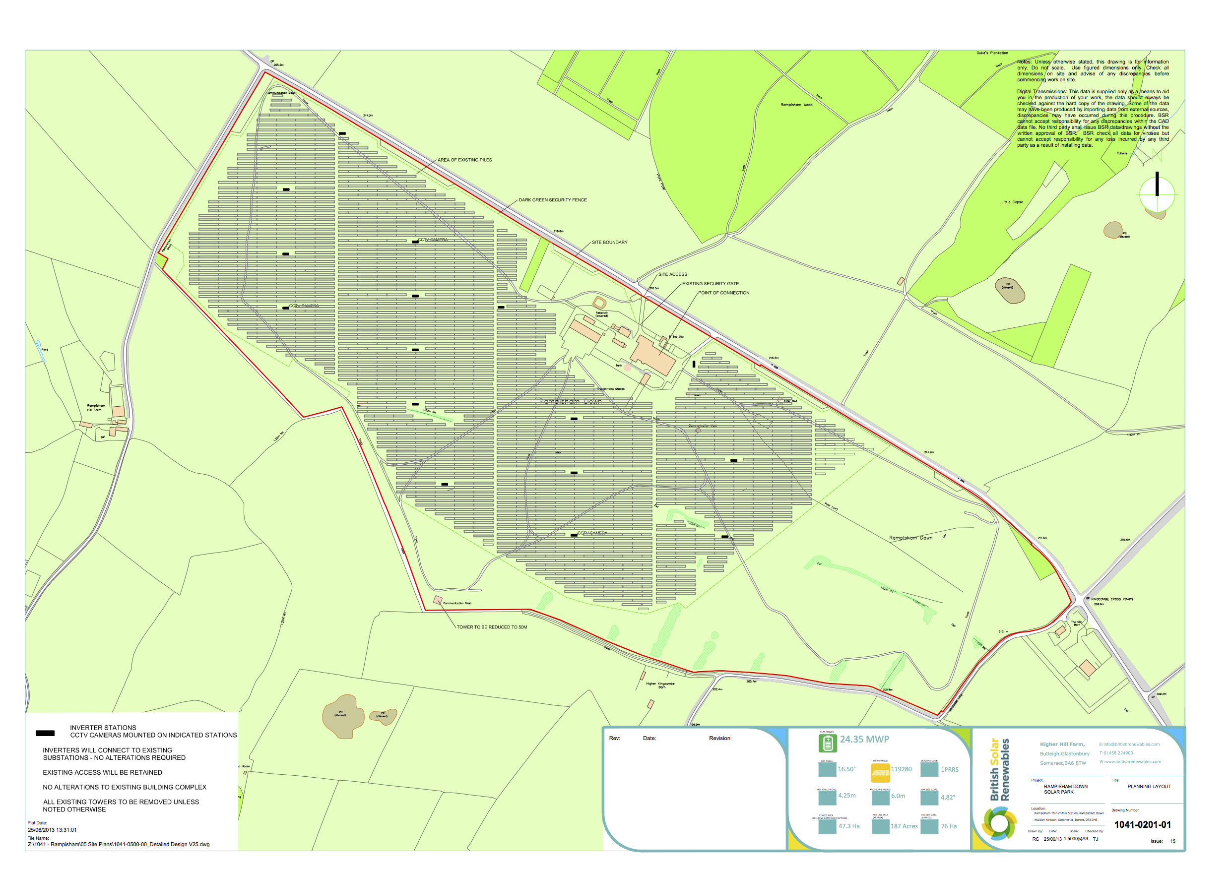
Now take a look at what BSR intend to do at Rampisham, and compare this with their photo showing their “test solar panel arrays”. The whole area of Rampisham covered by that photo will be covered in solar arrays.
If they get away with it, at that point Rampisham will certainly be transformed into an Industrial Brownfield Site.

As with all words, meanings are not fixed and are open to different interpretations, re-castings and misunderstandings.
In colloquial terms ‘brownfield’ means land that is derelict, has been built on, and is an eyesore that would royally benefit from having shiny new buildings on it.
Unfortunately this is not the technical definition of brownfield, in formal terms brownfield is equated precisely to ‘previously developed land’ (PDL). As you state the current definition is set out in the NPPF (with previously incarnations of the definition in PPG3).
In determining if land is PDL the first and implicit question is ‘was it previously developed?’ In this case the question is whether the planning application for the transmitting station mapped out an ‘application site’ that matches the current solar farm application site (or at least covers the vast bulk of the new site).
The current planning application states that:-
7.4.4 “Rampisham Down was once a short wave transmitter station” “There was no requirement on cessation of use to remove the buildings and ten of the transmission towers remain.” “Thus, for the context of this report, the site is previously developed land”.
http://wam.westdorset-dc.gov.uk/WAM/doc/Planning.pdf?extension=.pdf&contentType=application/pdf&id=745914
It seems likely that this primary test is met, although ideally one would have reference to the original planning application, if this still exists, (and the transmitter development may have been the result of several planning applications).
The NPPF definition then makes it clear that the term PDL only applies to land that has been “occupied by a permanent structure” (other than agricultural buildings), but also makes it explicit that the area considered to be PDL includes “the curtilage of the developed land”.
Curtilage is enclosed land that surrounds a building and belongs with it as part of the same property. The exact interpretation of the extent of curtilage is open to some debate on the basis of a range of factors for which case law is of some assistance. It is certainly not to be thought that the term only relates to land very close to the buildings, if the land and building have been fenced off as a unit and have the same ownership, approved use (e.g. application area) and operational management, then there is a robust argument that the whole site is curtilage. This would not be exceptional, curtilage “may be large enough for cattle to be levant and couchant therein” http://thelawdictionary.org/curtilage/
And those towers do seem to extend all around the whole area of the current application site – http://wam.westdorset-dc.gov.uk/WAM/doc/Planning.pdf?extension=.pdf&contentType=application/pdf&id=713695
A recent case – Lee Valley Regional Park Authority, R (on the application of) v Britannia Nurseries [2015] EWHC 185 (Admin) – supports the view that the existence of non-agricultural buildings is a key part of the assessment, and goes into depth to rule that sites (and their curtilage) where legal changes of use that convert agricultural buildings to non-agricultural use buildings prior to dereliction would still fall into the definition of PDL
http://www.bailii.org/ew/cases/EWHC/Admin/2015/185.html
In another case a Council was allowed to exclude railway land from the PDL definition because the buildings had been removed and the land had blended into the landscape through the processes of time “Apart from the one narrow platform and glimpses of a hardtop surface, there is now no evidence of the previous use” -Dodd and Hands v Secretary of State for the Environment Transport and The Regions [2002] EWHC 84 Admin http://www.haringey.gov.uk/sites/haringeygovuk/files/pwa_appendix_3_1.0.pdf
In this Rampisham case the buildings have not been removed and therefore cannot have blended into the landscape, hence the former (and partly current) use of the site remains pertinent.
While this is not black and white I can’t see a strong argument why the full curtilage of the transmitter development should not be treated as PDL.
A bunch of other factors do not influence the PDL definition – the colour of the site is irrelevant, as is the presence of vegetation, grazing animals, endangered species, important habitats, and indeed any other land classification or designation. There are plenty of very green brownfields that support endangered species and are of SSSI quality, some, including Canvey Wick, are now nature reserves and SSSIs.
While, given the current political attitude towards Brownfield/PDL, it is unfortunate that Rampisham Down appears to be PDL. But, this is not the same as saying that it is simply a derelict site in need of development. It is also an SSSI and an important wildlife site, so should therefore not be damaged by a misplaced solar farm.
Fortunately the policy bit of the NPPF does provide some important assistance as it states that “Planning policies and decisions should encourage the effective use of land by re-using land that has been previously developed (brownfield land), provided that it is not of high environmental value.”
This is not an amendment of the definition of the term PDL, but an indication that PDL should not be redeveloped where it has ‘high environmental value’.
This appears to be part of the objection to the development from Natural England – http://wam.westdorset-dc.gov.uk/WAM/doc/Planning.pdf?extension=.pdf&contentType=application/pdf&id=1117366.
I think that the ‘PDL or not PDL’ question is of significant academic interest in this case, but ultimately this categorisation is not the bottom line, both morally and legally, the key factor is the high wildlife value of the site.
Best wishes
Matt
thanks very much Matt.